SLIOCH
9.5 miles 1042 metres
Start Tuesday 16.36
Slioch (trig. Point) 18.17
Slioch (north top) 18.19
Finish 19.03

Squares: green - start, yellow - finish. Circles summits: green - this leg. Map Colin Matheson
Time: Estimated 2.30 Actual 2.27
I was fast asleep in the van at Kinlochewe when Rob's hooting brought me instantly awake to leap out and into the car. A two minute drive hardly woke me up, and as I set off down a farm drive barely able to run with sleep and a severe pain in my knees. As I slowly woke up the pain got worse.
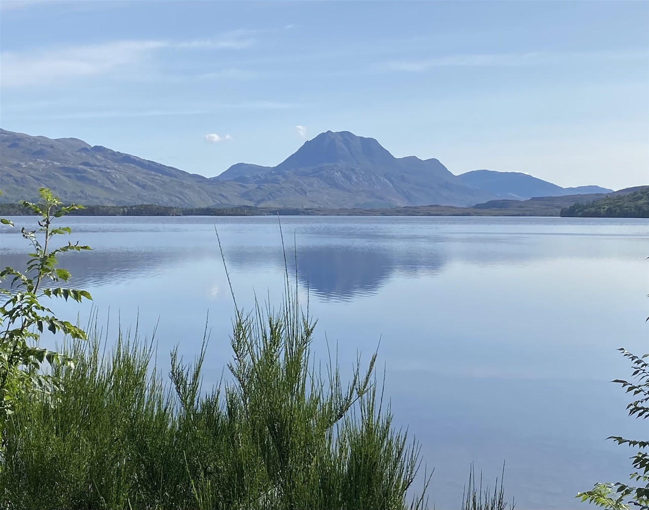
As I waded the Kinlochewe river and continued along the beautiful bank of Loch Maree, I was aware of the phenomenally high flood level from the previous winter. I was also aware of the of the beautiful light effects on the dramatic scenery. However I was wishing that someone else was doing it, and hoping desperately that my knees might be less painful climbing. It was not to be, but at least I would have walked up most of Slioch whatever.
The view as you ascend Slioch is not extensive until you suddenly burst onto the final few yards. This afternoon, it was breathtaking. I knew that some of the others were not too worried about every minute so I stopped for two minutes at the top. I could clearly identify every Munro that the team had so far done except for those hidden behind others. It seemed as though I could even see the rock strata on the Cuillins, over 50 miles distant.
It had taken me nearly one and three quarter hours to get up with every step giving pain. I was dreading the descent which included a drop off the incredibly steep northern ramparts about which I knew nothing, In fact, as I tried to run the gentle summit grass, the pain grew noticeably less. Half a mile later, as moss turned to rock it was still better, but the drop was about to come. Mercy of mercies, it turned out to be 1000 feet of the steepest bog I have ever met. Utterly soft to jump down, the only problem was the angle and the numerous vertical cliffs which had to be avoided, although falling down one of these would quite possibly have just created an extra big squelch.
Now, with an easier angled slope between me and Dave, I realised that the two and a half hour schedule might be possible. I waded the Glen Bianasdail river with over a kilometre of rough loch shore to go and ten minutes to spare. I only took seven, and my knees were no longer hurting.
Peaks done 78 time taken 3 days 16 hours peaks to go 199
It took me an hour to walk the two and a half miles to the track end where Dave had left the bike. Then a glorious if somewhat frightening descent of the rough track. The only physical effort required was balancing and the fingers for braking. For sections I slid down with no wheels turning – I was very grateful to Dave for pushing it up. The last two and a half miles were on a good quality track, and with an average gradient of 1 in seventy, was immensely enjoyable. The whole 5 mile ride took only 15 minutes.
Alwyn drove me round the inland route to Dundonnell with countless stops for evening photographs. When we arrived the others were extremely concerned about our lateness. Neither of us thought that we had been tardy – I do not think that sufficient allowance had been made for the walk out.
There is no charge for reading this account but please consider donating to Worldwide Cancer Research, the new name for the charity that we ran for.
Share this page