33A - BEINN ALLIGIN
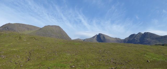
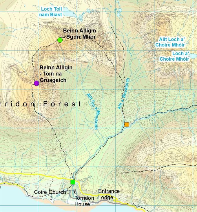
The length of Beinn Alligin. Eddie's route was directly up and down to the right of the gash. Map https://big-gorse-bush.blogspot.com/
4.3 miles 940 metres
Start Wednesday 12.18
Beinn Alligin 13.16
Finish 13.46
Squares: green - start, yellow - changeover. Circles summits: green - this leg, blue - not a Munro in 1993. Map Colin Matheson
Time: Estimated 1.30 Actual 1.28
After a longer night's sleep than expected I was rearing to go on this, probably the least enticing leg on the relay. Alligin means jewel and that is just what it is, however going up and down the quickest way is merely very hard, whilst missing all the mountain's joys. (Since then Beinn Alligin now counts as 2 Munros which would have given a more interesting route.) At least my sheltered route enabled me to run in a helly hansen, shorts and a bum bag.
All the locals assured us that yesterday had been the first rain for months, and looking at the dryness under the surface water it was impossile to disbelieve them. Now however, the “showers” were becoming steadily more continuous.
Graeme drove me to Coire Mhic Nobuill and I set off up the wonderful old path, so full of youthful memories, in a lull. I realised immediately that I was wearing different shoes – one bright blue size 9 with big studs, the other a dark size 8 rubberised! They seemed to grip equally.
I passed the first walkers on the whole relay, a damp looking foursome before I left the path, and cut across the big corrie floor to the right of the house sized boulders which have been deposited by Beinn Alligin's catastrophic past. This is evidenced by the enormous gash which is sliced out of its south face from just near the summit.
This face looks vertical from afar, but I knew from my teenage years that these impressive torridonian walls with tiers of sandstone crags are easily penetrated through the many breraks. It was a teacher who first took me down this way as he thought it safer than the more conventional “Horns”.
I found a good way up today missing most of the crags, and pushed on up very steep moss. A quick turn in the horizontal rain (sleet?) at the top and I was returning the same way. My thighs cramped almost immediately – the moss was offering almost no grip. With over 1500 ft to descend in 500 metres, this slope at 1:1 was not to be trifled with. However once down past the crags, the run over the moorland was a glorious flat out leg stretch sploshing through water, but with firm peaty ground underneath.
Ross somehow did not seem to reflect my joy as I passed the baton over to him, but he set off swiftly enough. I was grateful for his leggings for the walk back down the path in the heaving rain.
Peaks done 245 Hours elapsed 246 Peaks to do 32
There is no charge for reading this account but please consider donating to the RNIB, the charity we ran for.
Share this page

